The global climate change is thought to be one of the cause of recent drastic weather phenomenon which seemed on the world.
Satellite image data is useful for the education of importance of global environmental changes and preservations.
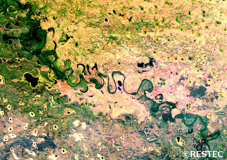
Fig 1. Tributary of Yukon River on the Alaska which was observed by ALOS.
Figure1 shows around of the tributary of Yukon River on the Alaska which is observed by ALOS. Chamerion angustifolium is growing in the area which looks pinkly. Chamerion angustifolium is known as the fire weed, and often grow in clumps after wild fire, it is considered the first step toward forest regeneration.
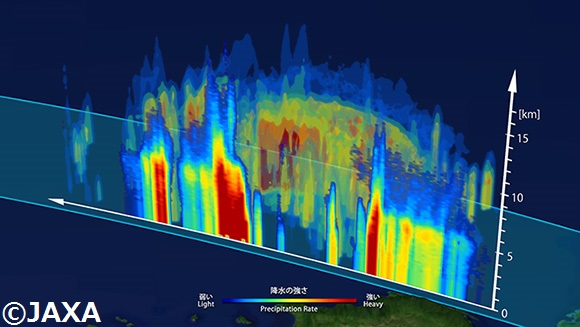
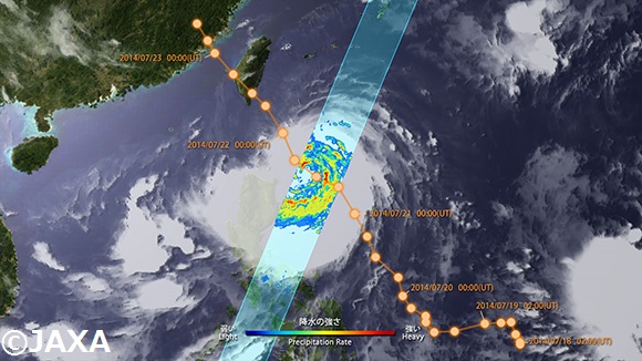
Fig 2. 3D image of typhoon MATMO on Jul. 22, 2014 observed by GPM/DPR(Upper).
2D Distribution of intensity of precipitation by GPM/DPR(Lower).
Figure2 shows the 3D and 2D image of typhoon MATMO on Jul. 22, 2014 observed by GPM/DPR. It is helpful for learning the structure of typhoon and distribution of precipitation.
In addition to what we introduced this time, G-Portal provides many kinds of satellite observation data. And JAXA is doing various efforts for Space Education.
http://edu.jaxa.jp/en/


 Example of use by years