


First of all, search the data you seek (no registration required)
* Registration required for download.
Search by:


Physical quantities
precipitation, ocean color, etc.


Spacecraft
spacecraft, sensor, level, etc.


Direct download
How to download via FTP, etc.


Login

User registration

Search this site:


Case Studies – Fishery demonstrated by GCOM
May 22 2019 Publish in
Information such as ocean conditions and the distribution of fish stocks are key to efficient fishing industry operations. One of the most basic pieces of information to ascertain these conditions is sea temperatures. Fish are sensitive to the surrounding water temperatures, and certain water temperatures are conducive to certain species. For example, fish distributed in warm currents prefer warmer water, and fish distributed in cold currents prefer cooler water. JAXA GCOM-W (Global Change Observation Mission – Water) satellite and JAXA GCOM-C (Global Change Observation Mission – Climate) satellite can be observed sea surface temperature. Figure 1 is an image of the estimated fishery plotted on the sea surface temperature distribution observed by GCOM-W. Fishery can be identified by sea water temperatures because fishery form where the water temperatures suit the specific species.
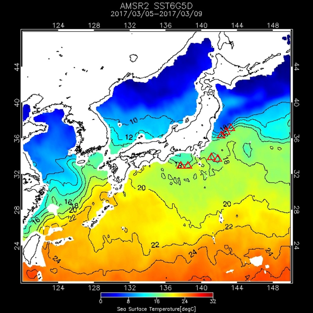
Figure 1 An image of the estimated fishery plotted(△:Fishery)
Local governments in Japan are using GCOM satellite data in fishery. Figure 2-4 shows cases of fishery demonstrated by GCOM satellite in local governments.
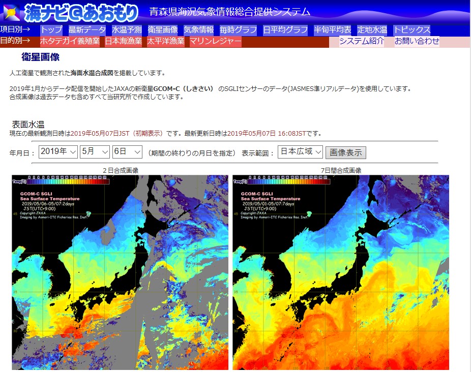
Figure 2 「Uminavi@Aomori」 by Aomori Prefecture
Source:https://www.aomori-itc.or.jp/uminavi/satellite.html
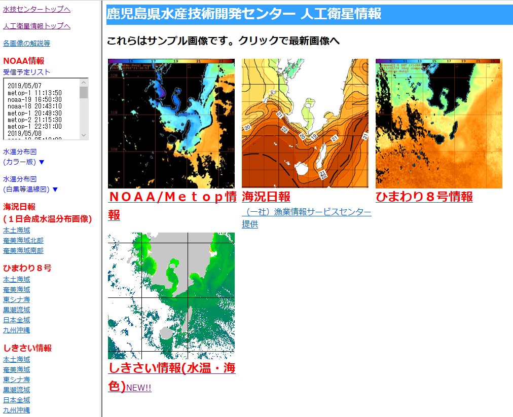
Figure 3 Satellite information by Kagoshima Prefecture
Source:http://kagoshima.suigi.jp/Websatelite/start.htm
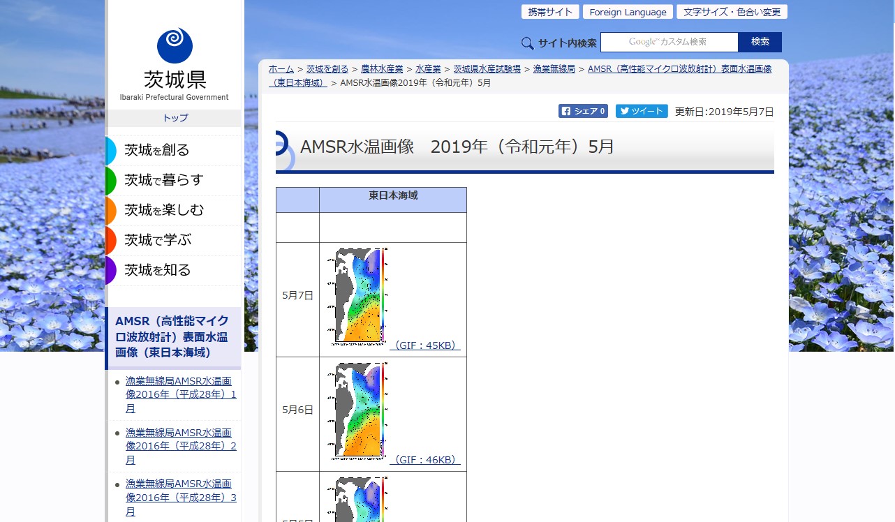
Figure 4 GCOM-W Sea-Surface-temperature Images by Ibaraki Prefecture
Source:http://www.pref.ibaraki.jp/nourinsuisan/suishi/gyogyo/gyomusen/amsr/2019/amsr201905.html
JAXA will promote research and development of earth observation satellites that contribute to society so that it will be used by more local governments.

Figure 1 An image of the estimated fishery plotted(△:Fishery)
Local governments in Japan are using GCOM satellite data in fishery. Figure 2-4 shows cases of fishery demonstrated by GCOM satellite in local governments.

Figure 2 「Uminavi@Aomori」 by Aomori Prefecture
Source:https://www.aomori-itc.or.jp/uminavi/satellite.html

Figure 3 Satellite information by Kagoshima Prefecture
Source:http://kagoshima.suigi.jp/Websatelite/start.htm

Figure 4 GCOM-W Sea-Surface-temperature Images by Ibaraki Prefecture
Source:http://www.pref.ibaraki.jp/nourinsuisan/suishi/gyogyo/gyomusen/amsr/2019/amsr201905.html
JAXA will promote research and development of earth observation satellites that contribute to society so that it will be used by more local governments.
 Example of use by years